
Understanding the DJI Zenmuse L2 LiDAR System
The dji zenmuse l2 represents a significant evolution in aerial surveying technology, particularly for professionals in fields such as mapping, civil engineering, and environmental management. By integrating advanced LiDAR capabilities with high-resolution imaging, it provides unparalleled data accuracy and efficiency in one compact solution. As industries increasingly turn to drone-based technologies, understanding the capabilities and applications of the Zenmuse L2 becomes crucial for maximizing operational efficacy.
What is the DJI Zenmuse L2?
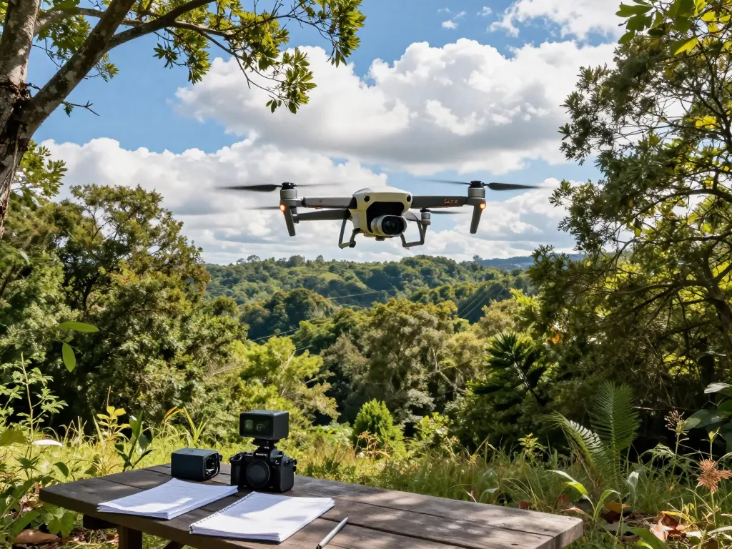
The DJI Zenmuse L2 is a professional-grade LiDAR sensor designed specifically for use with DJI’s Matrice drone series, including the Matrice 300 RTK and Matrice 350 RTK. It combines a robust LiDAR system with a four-thirds CMOS RGB camera, enabling high-resolution aerial mapping and surveying. This synergy of technologies allows users to capture extensive datasets with precision, which can be utilized for a wide range of applications from topographic mapping to infrastructure analysis.
Key Features and Specifications
- LiDAR Technology: The L2 employs a frame LiDAR system that boasts a vertical accuracy of up to 4 cm, significantly enhancing the reliability of surveys.
- High-Resolution Imaging: Equipped with a 4/3 CMOS camera, it captures detailed RGB images that complement LiDAR data, fostering enhanced visualization of collected information.
- Compact Design: Designed to fit seamlessly on DJI drones, the L2 maintains a lightweight yet sturdy structure, optimizing flight efficiency.
- Advanced Processing Algorithms: The system incorporates innovative algorithms for point cloud processing, ensuring high-quality output and minimizing post-processing time.
How the Zenmuse L2 Stands Out in 2026
In 2026, the DJI Zenmuse L2 continues to set industry standards with its remarkable ability to adapt to various operational needs. The integration of AI-driven analytics allows users to interpret data more efficiently, identifying patterns and anomalies that may not be immediately visible. As industries like agriculture and urban planning evolve, the demand for such versatile tools increases, making the L2 a go-to solution for professionals seeking to leverage technology for optimized decision-making.
Applications of the DJI Zenmuse L2 in Various Industries
Utilizing the L2 for Aerial Surveying
Aerial surveying is one of the most significant applications of the DJI Zenmuse L2. Its ability to quickly and accurately capture data sets makes it invaluable for geospatial analysis and topographic mapping. Surveyors can deploy the Zenmuse L2 to map large areas in a fraction of the time it would take using traditional methods, minimizing labor costs and increasing productivity.
Impact on Environmental Monitoring
The Zenmuse L2 is pivotal in environmental monitoring, allowing for detailed assessments of land changes, forest health, and habitat mapping. By employing LiDAR data, environmentalists can accurately measure vegetation density and biomass, helping to track ecological changes over time. This capability is particularly important for conservation efforts and climate change studies, where precise data is crucial for informed decision-making.
Role in Construction and Infrastructure Development
In construction, the Zenmuse L2 enhances project planning and execution through rapid site assessments and ongoing monitoring. It allows project managers to visualize terrain and plan efficiently, significantly reducing time and costs associated with manual surveying. Furthermore, regular aerial inspections can be performed throughout the construction phase, ensuring adherence to design specifications and identifying potential issues early.
Performance Metrics of the DJI Zenmuse L2
Precision and Accuracy in Data Capture
The precision of the DJI Zenmuse L2 is one of its most celebrated features. With advanced LiDAR technology, measurements can achieve vertical accuracies of 4 cm and horizontal accuracies of up to 5 cm under optimal conditions. This level of detail is essential for applications where accuracy is non-negotiable, such as civil engineering and geological assessments.
Comparison with Previous Models: L1 and Other Competitors
When compared to its predecessor, the Zenmuse L1, the L2 showcases several key improvements, including enhanced point cloud density and accuracy. The reduction in point cloud thickness from around 12 cm to 5 cm or less highlights significant advancements in technology, making the L2 a superior choice for professionals. Additionally, when evaluated against competitor models, the Zenmuse L2 often emerges victorious due to its seamless integration within the DJI ecosystem and user-friendly operation.
Real-World Case Studies and Results
Numerous case studies underscore the effectiveness of the Zenmuse L2 in various sectors. For example, a recent project in urban surveying showcased how the L2 enabled the rapid mapping of a complex urban environment, providing detailed 3D models that aided in city planning. Similarly, in forestry management, the L2 was used to monitor tree growth and assess forest health, demonstrating its versatility and effectiveness across different environments.
Best Practices for Using the DJI Zenmuse L2
Setting Up Your Equipment for Optimal Results
To maximize the potential of the DJI Zenmuse L2, proper setup is essential. Users should ensure the drone is calibrated correctly, with GPS coordinates accurately set before deployment. Additionally, planning flight paths to cover the survey area efficiently can save time and enhance data quality.
Data Processing Techniques for Enhanced Output
Data processing is a crucial component of using the Zenmuse L2. Employing software tools specifically designed for LiDAR data can significantly enhance the clarity and utility of the produced point clouds. Techniques such as filtering, classification, and the use of artificial intelligence for data analysis can elevate the quality of insights derived from collected data.
Maintaining Your DJI Zenmuse L2 for Longevity
Regular maintenance of the DJI Zenmuse L2 is vital for ensuring longevity and optimal performance. This includes keeping the sensor clean, checking for firmware updates, and conducting routine inspections of the hardware. Users should also ensure that all components are functioning correctly post-flight to maintain the integrity of the equipment.
Future Trends and Developments in LiDAR Technology
Emerging Innovations for 2026 and Beyond
As the field of LiDAR technology continues to grow, several trends are emerging. Future developments may include enhanced sensor resolution, increased operational ranges, and integration with other technologies such as photogrammetry. These advancements will likely expand the applications of aerial mapping and assessment, pushing the boundaries of what is currently possible.
Integration with AI and Automation
AI and automation represent a significant frontier for LiDAR technologies like the DJI Zenmuse L2. The ability to analyze massive datasets automatically can drastically reduce the time required for data interpretation and decision-making. This integration is anticipated to enhance user experience and outcomes in various industries, making workflows more efficient and effective.
Market Predictions for LiDAR Systems
The market for LiDAR systems is expected to see substantial growth in the coming years, driven by demand for accurate data across multiple sectors. As more organizations recognize the value of deploying drones equipped with advanced sensors like the Zenmuse L2, there will be an increase in adoption rates and a corresponding drive towards innovative applications of this technology.
What drones are compatible with the Zenmuse L2?
The Zenmuse L2 is specifically designed to be compatible with the DJI Matrice 300 RTK and Matrice 350 RTK drones, ensuring that users can leverage the full capabilities of both the drone and the sensor while maintaining optimal performance.
How accurate is the DJI Zenmuse L2 LiDAR system?
The DJI Zenmuse L2 boasts impressive accuracy metrics, with vertical accuracies reaching up to 4 cm and point cloud thickness significantly reduced to enhance data reliability. These capabilities make it an excellent choice for professionals requiring precise measurements.
What industries benefit from the Zenmuse L2?
Industries such as construction, environmental monitoring, agriculture, and civil engineering greatly benefit from the capabilities of the Zenmuse L2. Each of these sectors uses the sensor to enhance productivity, improve data accuracy, and support informed decision-making processes.
Is the DJI Zenmuse L2 worth the investment?
For professionals in industries that rely on high-quality data collection and analysis, the DJI Zenmuse L2 represents a compelling investment. Its advanced features and capabilities justify its cost, especially when considering the potential reductions in time and increases in accuracy it provides.
What are the upgrades in the L2 compared to its predecessor?
The DJI Zenmuse L2 improves upon its predecessor, the L1, through enhanced vertical accuracy, minimal point cloud thickness, and superior overall performance. These upgrades make it more viable for various applications, reinforcing its position as a leader in the LiDAR market.